- Date
- vendredi 1 décembre 2023
- Auteur
- Colin Garritty, Lead Field Technician/Forecaster - Vancouver Island
By now, it should be clear the snow season in most of Western Canada is off to a pretty dismal start.
Whether you’re still on your rock skis or you’re still rock climbing, conditions have been, well, a bit rocky. Over the past few weeks of drought, snow on the ground has steadily weakened and formed nasty surfaces. This snow won’t shoulder much load or bond well with new snow. In areas with enough snow on the ground to form a uniform surface, you can bet it will form a tricky layer in the snowpack. So what does this mean for avalanche conditions?
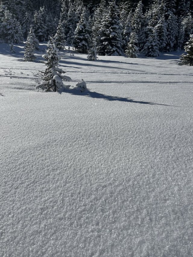
MIN from Round Mountain - Garibaldi Polygon - Nov 24
The early December outlook
We selected images for this blog that paint a clear picture of the trouble in our immediate future, once the surfaces out there start getting buried and the snowpack is loaded by storm snow.
Coastal regions
In areas forecast to get lots of snow over the next few storms, the snowpack’s response will be swift. Thick storm slabs will form and bring critical loads to weak surface grains, producing lots of avalanches. Initially, the scale and extent of avalanche activity will likely be dictated by the amount of new snow and factors like wind loading. In the coming weeks though, these newly buried surfaces may become the deciding factor in avalanche size and likelihood.
In shallower snowpack areas toward the east of the Coast Range, we may see avalanches failing right at ground level. Granted, that isn’t very far from the surface of the snow right now! The fact that so much ground roughness is still present in the terrain will also limit avalanche runouts and the connectivity of slabs across terrain.
The hope is that these big warm storms crush our problem layers and leave us with a deeper, much more consolidated snowpack. This would also be a pretty typical coastal scenario.
Interior regions
The interior has a lot less snow in the forecast and our expectations are less clear-cut. Areas that see slower accumulations and lower storm totals may not get the widespread avalanche cycle we’d like to see. Areas with less extensive cycles will probably see problem layers remain intact, as the light loading of new snow won’t compress the snowpack very much.
This leaves us more uncertain about the future in the interior and asking questions like: “Which storm will be the one to overload the snowpack structure?” and “How many areas still have surface hoar preserved under the storm snow?” If snow cover remains thin, a December cold snap could cause damage by continuing faceting processes that have already been at work and undermining snowpack strength. This is not a totally uncommon situation for the interior.
What about a season outlook?
The early season is an important time in the development of the season’s snowpack. It’s essentially when our foundation is laid, so this is a reasonable question to ask. The answer is that this early season setup is common. A bad early season snowpack isn’t a guarantee of a bad season for avalanches. Even with knowledge of the early snowpack and a grasp of seasonal patterns like El Niño, avalanche conditions are far too reliant on day-to-day and week-to-week weather changes for us to accurately predict the character of the avalanche season.
What’s next?
Snow dances. Lots of them.
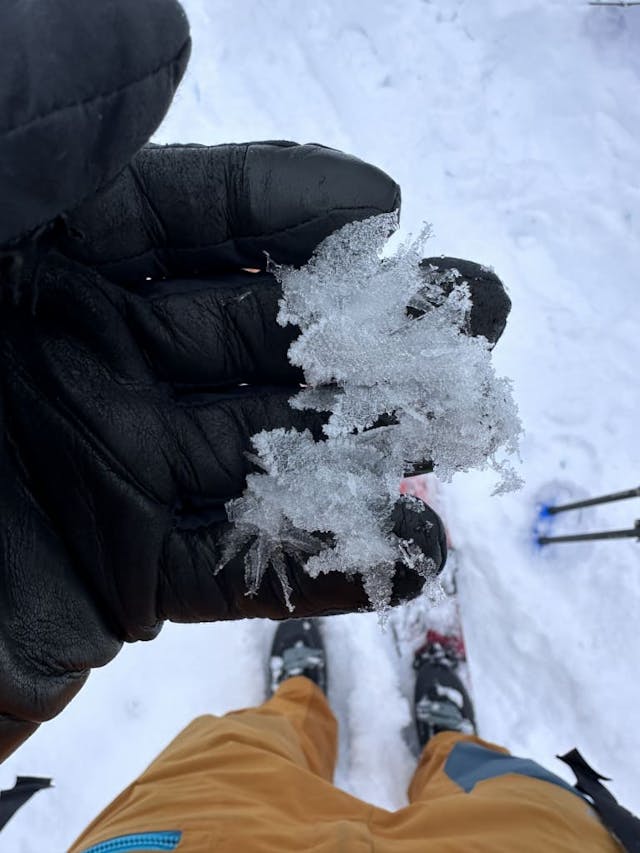
MIN from Mount McRae - Central Selkirk Polygon - Nov 27