- Date
- Wednesday, March 13, 2024
- Author
- Simon Horton, Avalanche Forecaster
The coming days are bringing a significant change of weather and a widespread increase in avalanche danger. A combination of existing snowpack instabilities and unseasonably warm weather means the potential for large and dangerous avalanches.
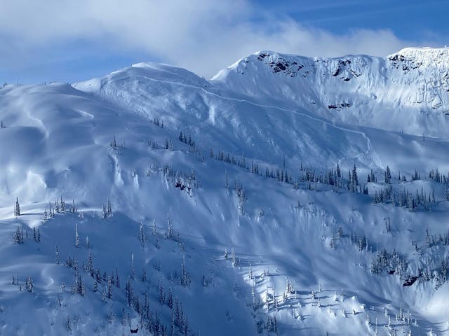
A large persistent slab avalanche which failed on the early Feb weak layer in the Monashees near Revelstoke last week. These types of avalanches are expected to continue with the upcoming warming and sun.
Part 1: The setup
Most of western Canada has been entrenched in a pattern of large human-triggered avalanches since the start of March. The culprit of these persistent slab avalanches is a weak layer above a crust that formed in early February. The behaviour of these avalanches is alarming, with many being triggered remotely, releasing in low angle terrain, and starting part way down slopes. These avalanches have persisted almost daily throughout March, despite the layer getting buried deeper and deeper.
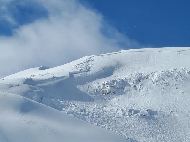
Persistent slab avalanche remotely triggered by skiers in lower angle terrain in the Cariboos on March 3 (MIN report from CRAIG HARTMETZ).
Part 2: The forecast
Sudden and significant warming is hitting the coast on Thursday and the interior on Friday, with sunny skies and double digit temperatures continuing over the weekend. The impact of this warming is clear—a spike in avalanche danger, with large natural avalanches.
We expect that:
- Regions with persistent slab avalanche problems (which includes most of them), can expect very large natural slab avalanches (size 3 to 4!).
- Wet loose avalanches will occur on sun-exposed slopes.
- Cornices will break, and potentially trigger avalanches on the slopes below.
In addition to natural avalanches, all the above types of avalanches will be very sensitive to human triggering.
Forecasting persistent slab avalanches can be tricky, but under these conditions it is not. The combo of a hyper-sensitive snowpack with intense warming is a recipe for high danger.
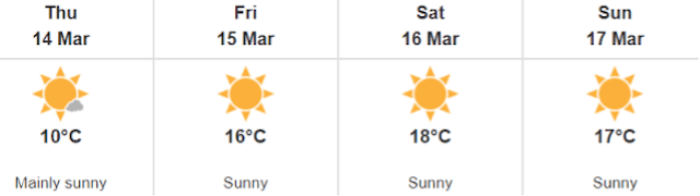
Forecast for Whistler village from Environment Climate Change Canada.
Part 3: The takeaway
Once the warming arrives in your region, we strongly recommend the following precautions:
- Choose activities or routes that do not require exposure to avalanche terrain.
- Avoid crossing below avalanche paths, including valley bottom trails that pass through runouts.
- Remember that many avalanches have been triggered remotely from low angle terrain.
It's a straightforward message – avoid avalanche terrain.
Let's all hope for improved conditions once temperatures return to seasonal norms!
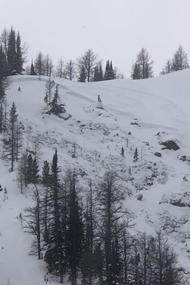
Remotely-triggered avalanche in Kananaskis Country on March 11 (MIN report from MAJOSRNIK).