- Date
- Tuesday, February 4, 2020
Avalanche Canada has made ATES-rated areas available for download through our online trip planner.
Maps of regions that have been rated with the Avalanche Terrain Exposure Scale (ATES) are now available for download from Avalanche Canada.
All of the managed snowmobile areas in BC have been ATES rated, as have a number of BC Parks popular with backcountry users. Avalanche Canada, in partnership with Parks Canada, has also rated the mountainous terrain on the west coast of Newfoundland, in and around Gros Morne National Park.
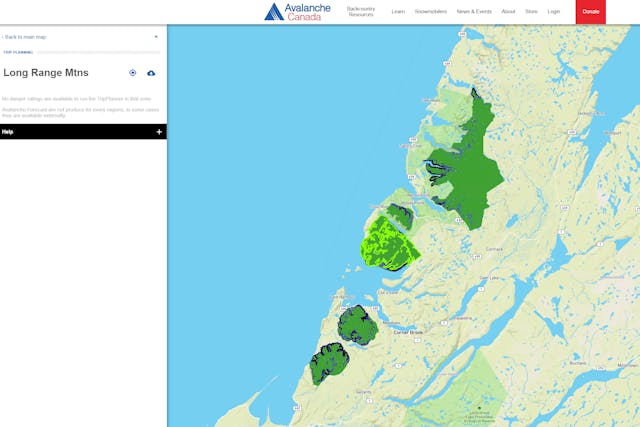
ATES-rated terrain in Newfoundland.
ATES is a three-step scale used to communicate how much a given piece of terrain is affected by the potential for avalanches.
- Simple terrain (green) is either low-angled or forested terrain with no or very little exposure to avalanches. There are many options to reduce or limit exposure.
- Challenging terrain (blue) involves exposure to well defined avalanche paths, start zones, or terrain traps. There are options to reduce or eliminate exposure with careful route finding.
- Complex terrain (black) involves exposure to multiple, overlapping avalanche paths or large expanses of steep, open terrain with minimal options to reduce exposure.
The zones that have been ATES rated are displayed on Avalanche Canada’s Trip Planner page. Our online trip planner combines the current avalanche danger rating with the terrain ratings, providing decision-making guidance for planning backcountry trips.
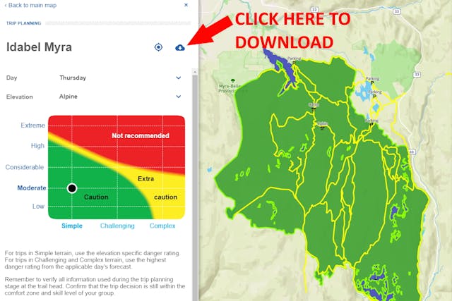
To download KMZ files of your favourite riding area, first select the area using the Trip Planner map. Then click on the download icon displayed to the right of the zone’s name (see image below). These files can then be displayed in your favourite digital map application.