- Date
- Friday, November 12, 2021
How wildfires affect the avalanche conditions
Everyone is aware of the serious effects of the 2021 wildfires in British Columbia and other parts of North America. Forests burned off, homes and businesses were lost, and entire communities were destroyed. We feel fortunate at Avalanche Canada that none of our staff or facilities were affected, and our thoughts are with those who suffered losses.
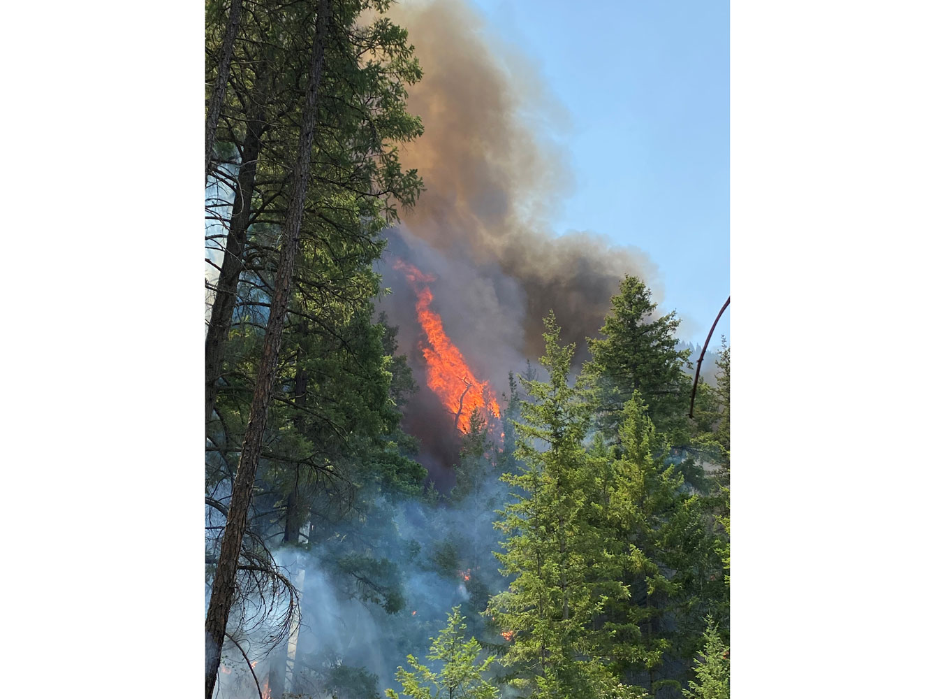
A wildfire burns a mountainside. Photo: Aleks Klassen.
A less recognized effect of wildfires is the potential for increased debris flows. When fires are intense, vegetative cover burns and root systems are destroyed. This results in loss of soil stability on steep slopes. The removal of surface organics (duff and litter) means there’s less vegetative matter to absorb moisture. And in some cases, when fire conditions are right, hydrophobic soil is created, which prevents water from penetrating the surface. This forces water to run off in much greater volumes and much faster than normal. These factors can lead to more and bigger debris flow events.
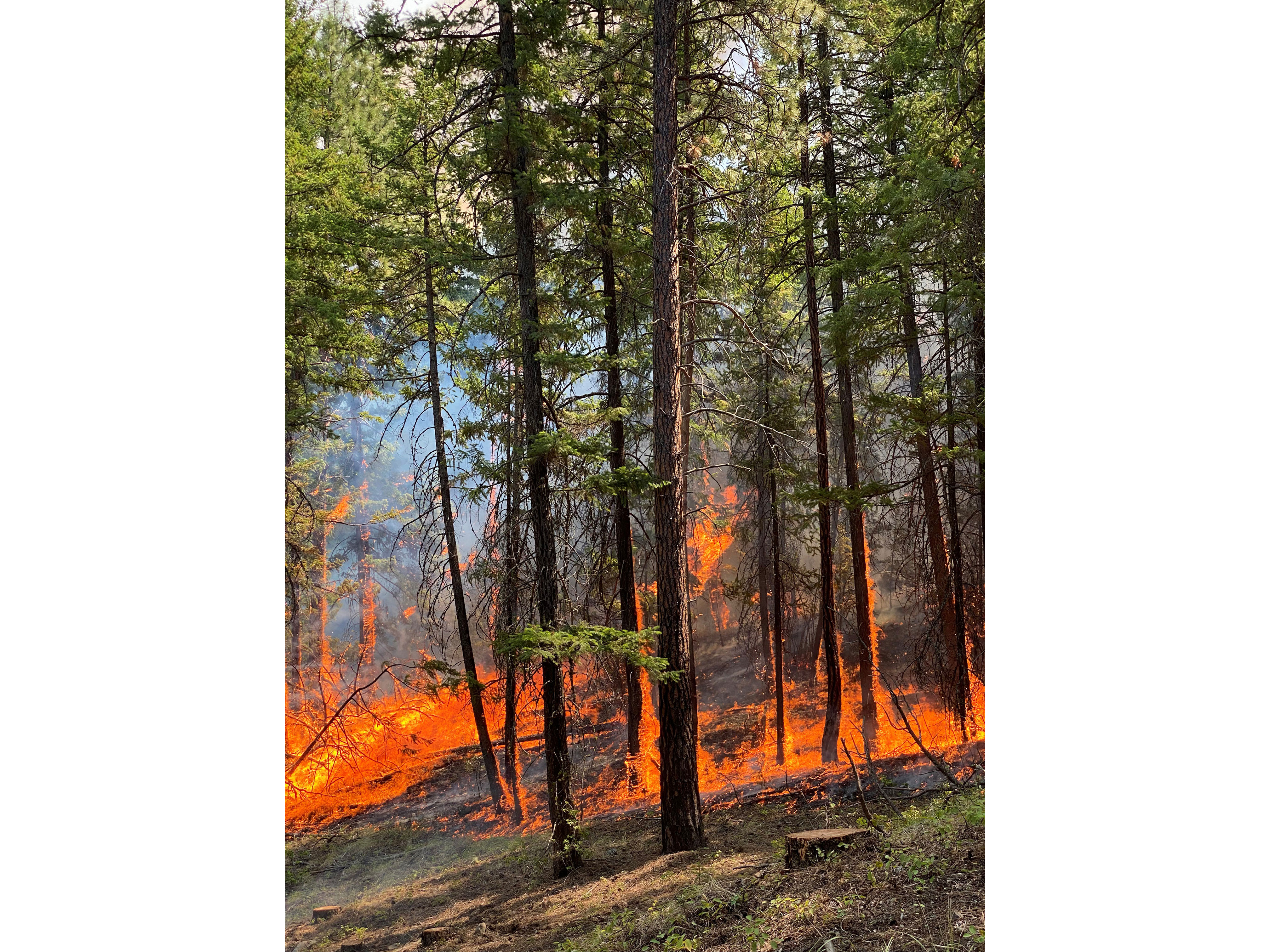
This summer's wildfires destroying vegetation. Photo: Aleks Klassen.
Some of the factors that increase the chance of debris flows also increase the likelihood of avalanches. A loss of trees removes anchors that hold snow in place. Removal of undergrowth creates a smoother ground surface that is less able to keep snow in place. These lower threshold snow depths can result in more avalanches.
Slopes with less tree cover are more exposed to wind and sun, which may create a snowpack with more and different layers than before the fire. Sun crusts, wind crusts/slabs, and even surface hoar layers are much more common in the open areas and sparse trees found after a fire event. These kinds of layers are associated with different (and probably more) avalanche activity than may have been common pre-fire.
Avalanche terrain ratings have almost certainly been impacted in areas where fire has significantly altered vegetation cover on steep slopes. After a major burn, slopes will almost certainly warrant a higher Avalanche Terrain Exposure Scale (ATES) rating. Changes in ratings will not be reflected on existing maps unless an area is re-mapped to account for the altered ground cover.
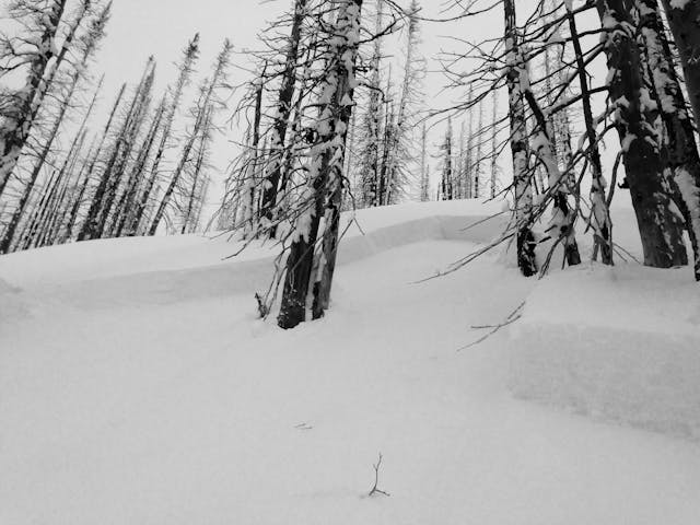
An avalanche crown in an area of burned forest. Photo: Grant Helgeson.
Here are some things to consider when in fire-affected avalanche terrain this winter:
- When using tools like the Avaluator Trip Planner and Slope Evaluation card, which rely on ATES ratings as part of the decision making process, be aware that ATES ratings for areas that have burned since they were mapped may not be accurate.
- Be wary when the snowpack contains free water in burned areas. Water can percolate right down to the base of the pack. If it encounters hydrophobic soil at the snow/ground interface, wet avalanches might be more likely than normal. Even worse, an already destructive wet avalanche might become even more dangerous if it mixes with a debris flow.
- Sparse trees and burnt stumps may give a false sense of security on steep slopes. Surface hoar forms readily in these zones, and the snowpack may not be sufficiently anchored to prevent an avalanche when persistent slab conditions are present. Instead, snags may act as dangerous obstacles that could increase trauma if an avalanche were to occur.
- Avalanche forecasts can’t address the challenges you might encounter when in wildfire affected areas this winter. Only you can recognize if an area has changed due to fire and assess if you should take additional precautions. Perhaps the most important thing in all this is to not take your traditional knowledge about the snowpack and avalanches for granted if you’re headed to a familiar spot and find it’s been burned since you were last there.
Karl Klassen